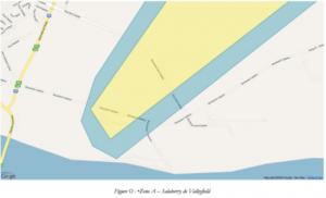
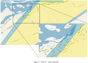
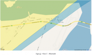
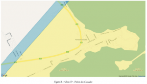
*Click on the maps to enlarge them
Salaberry-de-Valleyfield
From number 900 to 1012 of boulevard Cadieux
From number 500 to 900 of boulevard des Érables
Saint-Timothy
The entire zone delimited by the Fleuve Saint-Laurent to the north, the boulevard Hébert to the south and to the east of the 5ième Avenue. The entire zone delimited by the boulevard Hébert to the north and highway 30 to the south and to the east of street Denise.
The streets partly exposed within this zone are:
The street des Lilas, from number 48 to 92
The street Irène, from numbers 2 to 10 and the numbers above 38
The street Denise, starting from number 2
The 4e Street, starting from number 100
The street St-Laurent, starting from number 206
The boulevard Hébert, starting from number 5010
Intersection of boulevard Pie XII and rang Sainte-Marie
The numbers 2 to 418 of rang Sainte-Marie O.
The numbers 2 to 400 of rang Sainte-Marie E.
The numbers starting from number 2 of boulevard Pie XII
All of highway 132 between Saint-Timothée and Melocheville
Melocheville
The entire municipality of Melocheville
Pointe-des-Cascades
The route 338, from 1ière Avenue to the street Meloche
The chemin du Fleuve, the chemin Saint-Antoine and the street Centrale
The chemin du Fleuve, the chemin du Canal and the street Centrale


